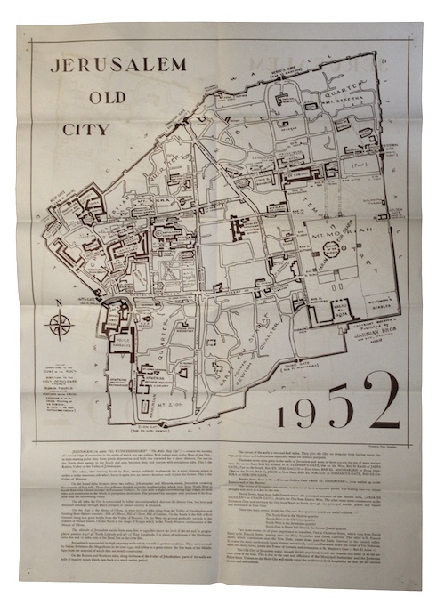
[Caption title:] Jerusalem map 1952.
[Jerusalem].
[Jahshan Bros.], [1952].
Dimensions 480 x 660 mm.
Single sheet, printed on one side only. Pasted into original publisher’s pictorial powder blue wrappers. A trifle creased.
A large sketch map depicting the city of Jerusalem as it appeared in the mid-twentieth century (including the demilitarised zone), issued by Ghattas J. Jahshan and Maheeba Akra Jahshan, authors of Guide to the West Bank of Jordan (1961).
£ 75.00
Antiquates Ref: 28029