THE WORLD DISSECTED - CHARTING COOK'S COURSE
[The world].
London.
Darton, [s.d., between 1808 and 1866]
480 x 250 mm. Box dimension 207 x 160 x 550 mm..
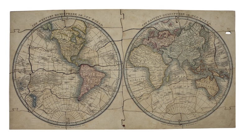
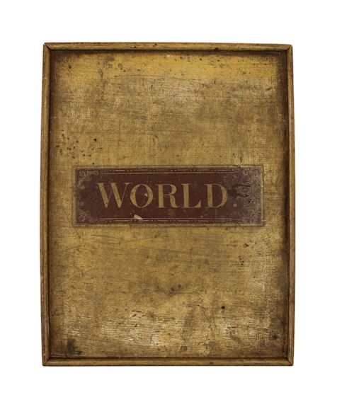
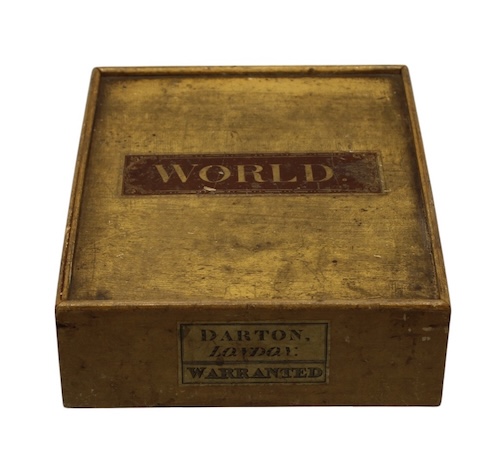
One hand-coloured engraved map, mounted on wood, dissected into 47 pieces; displaying two hemispheres, each 230cmm in diameter. A little marking to surface, one plug missing. Preserved in the original wooden box (?light pine), with a sliding top; the latter featuring the printed label 'World', the side of the box with another reading 'Darton, London: Warranted' .
A rare Darton twin-hemispherical dissected map of the world, designed as an educational aid to assist geographical understanding, which records in remarkable detail the tracks of Captain James Cook's three voyages in the South Seas, 1768 through 1779.
Unlike earlier Darton twin hemispherical maps (such as A World, Neatly Dissected, 1811, and The world dissected upon the best principles to teach youth geography, 1820), Van Diemen's Land is here shown as an Island. As with that earlier example, however, the South Pole is shown without any presence of a land mass.
Both Western and Eastern Hemispheres feature the distinct charting of the three Cook voyages; these not only reveal the full extent of enduring popularity of his impact on geographical understanding; but, commercially, were a fine opportunity to add detail to areas of the maps - and specifically the Pacific Ocean - which would be otherwise relatively devoid of features.
We've been unable to locate any exact match for this dissected map; others, such as the 1811 and 1820 examples, in 30 pieces, are themselves rarely encountered. These are held at Princeton and New South Wales respectively.
£ 3,000.00
Antiquates Ref: 33548
Unlike earlier Darton twin hemispherical maps (such as A World, Neatly Dissected, 1811, and The world dissected upon the best principles to teach youth geography, 1820), Van Diemen's Land is here shown as an Island. As with that earlier example, however, the South Pole is shown without any presence of a land mass.
Both Western and Eastern Hemispheres feature the distinct charting of the three Cook voyages; these not only reveal the full extent of enduring popularity of his impact on geographical understanding; but, commercially, were a fine opportunity to add detail to areas of the maps - and specifically the Pacific Ocean - which would be otherwise relatively devoid of features.
We've been unable to locate any exact match for this dissected map; others, such as the 1811 and 1820 examples, in 30 pieces, are themselves rarely encountered. These are held at Princeton and New South Wales respectively.